What the records say
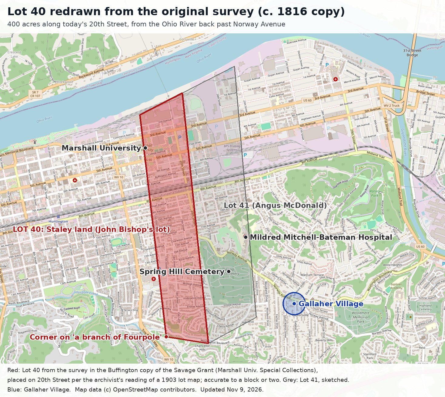
- The Buffington copy of the Savage Grant (Marshall University Special Collections) describes Lot No. 40 as John Bishop's lot, "assigned in 1775 to Van Swearengen": on the Ohio River, beginning at a beech on the road at the upper corner of Lot 39, running up the river 29 chains 10 links to a Spanish oak, then back 154 chains to the rear line, to a white oak "on the south side of a branch of Four pole," containing 400 acres, of which 246 were river bottom.
- Lot 41, the next lot upriver, was assigned in 1775 to Angus McDonald. On the 1903 lot map it takes in today's Mildred Mitchell-Bateman Hospital and the old Oley School.
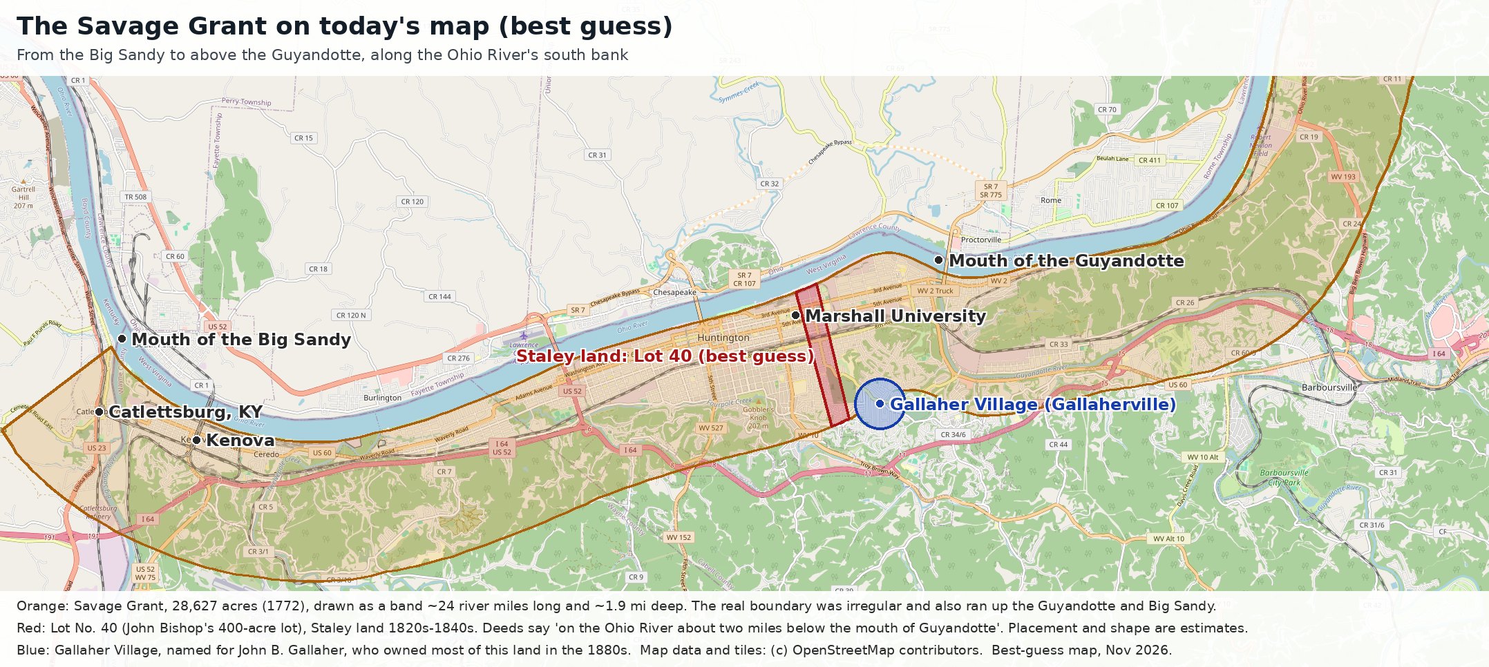
- Cabell County deeds place Stephen Staley's land "on the Ohio River about two miles below the mouth of Guyandotte," in Lot No. 40 of the Savage Grant: a 400-acre lot assigned in the 1775 division to John Bishop.
- Stephen and Barbara Staley sold 150 acres of the upper part of the lot to Solomon Thornburg in 1823. Stephen conveyed 125 acres to Joseph and Michael Staley in 1825. In 1840 a court commissioner sold Joseph and Michael 200 acres, the upper half of the Bishop lot.
- Gallaher Village, first called Gallaherville, is named for John B. Gallaher, who owned most of the land around today's Norway Avenue in the 1880s. How he acquired it, and which Savage Grant lot it came from, has not yet been traced.
What it means
The Staley land was a strip about four city blocks wide running from the Ohio River south along today's 20th Street, through what is now part of Marshall University's east side, past Spring Hill Cemetery's western edge, and back to the hills near Washington Boulevard. Gallaher Village is not on it. The village lies east of Lot 41, about two-thirds of a mile from the Staley lot's eastern line. The Staleys had sold or left the lot by the 1840s, decades before John B. Gallaher's time.
One detail is worth following up. The lot was assigned in 1775 to a "Van Swearengen." A Van Swearingen family was prominent in Shepherdstown and Berkeley County, Virginia, where the Staleys lived before they moved west. Whether that is how Stephen Staley came to the lot is not yet known.
See also the working-draft family history and the interactive family tree.
Sources: Thomas J. Buffington Copy of Savage Land Grant, circa 1816, Marshall University Special Collections (digitized copy); 1903 partial lot map and guidance from Marshall University Special Collections; Cabell County deeds. Map data and base tiles © OpenStreetMap contributors. Overlays drawn November 2026.