The C&O controls the pace
Sixty towpath miles can feel like a longer paved ride. Wet limestone, roots, puddles and loaded tires consume time and battery. Leave early and treat 15 mph as a ceiling, not a target.
Washington, DC → Pittsburgh · Westbound
A six-day, hotel-first e-bike plan for 334 miles of canal history, Appalachian forest and nearly continuous car-free riding.
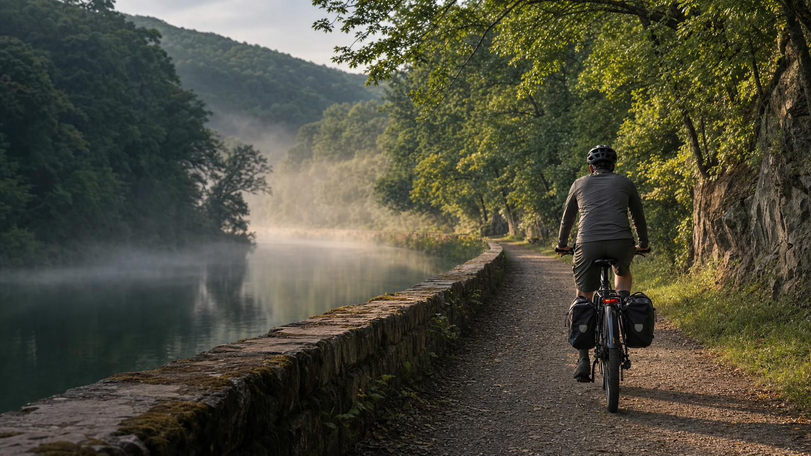
The first 184.5 miles follow the C&O Canal Towpath from Georgetown to Cumberland. It is historic, shaded and wonderfully quiet—but also rougher, muddier and farther from services than a paved greenway. The National Park Service does not provide e-bike charging along the towpath.
At Cumberland, the route becomes the 150-mile Great Allegheny Passage. The first 23.7 miles climb steadily to the Eastern Continental Divide; after that, the grade falls almost imperceptibly toward Pittsburgh. This plan reverses the GAP Conservancy's published six-day itinerary and keeps its proven overnight towns.
Sixty towpath miles can feel like a longer paved ride. Wet limestone, roots, puddles and loaded tires consume time and battery. Leave early and treat 15 mph as a ceiling, not a target.
Dry the bike, inspect pads and tires, charge every battery and start the mountain day fresh. The climb is gentle but continuous: 1,767 feet over 23.7 miles.
Ask each property about secure bike storage and battery charging before booking. Never charge a wet, hot, damaged or unattended pack, and use only the approved charger.
The operating rule
Book the room. Confirm the outlet. Check the trail again the morning you roll.
This is a dated snapshot, not a promise about your departure week. Open both official alert pages again 72 hours before departure and on the morning of each affected stage.
Byron Bridge work is affecting the stair connection between the towpath and town. The towpath remains through-ridable, but moving a loaded e-bike into Harpers Ferry may require a changed overnight plan.
Open the NPS project notice ↗Dam No. 5 work uses a short mulch-and-stair detour. The Polly Pond bridge closure uses roughly two miles of the Western Maryland Rail Trail, where only Class 1 e-bikes are permitted.
Open current C&O conditions ↗A two-mile Duquesne–Homestead segment is closed for rock work. A paid daytime bicycle shuttle is operating; GAP explicitly warns against using PA-837 as a road detour.
Open the GAP closure notice ↗E-bike access
NPS permits e-bikes with operable pedals and a motor under 750 watts where traditional bicycles are allowed. Except on public motor roads, the motor may not move the bike without pedaling. Maximum speed is 15 mph.
Read the NPS bicycle rules ↗GAP permits devices with fully operating pedals, motors of 750 watts or less, weight under 100 pounds and width no greater than 36 inches. The trail speed limit is 15 mph.
Read the GAP rules ↗The optional paved parallel trail—and the current Polly Pond detour using it—permits only Class 1 e-bikes. A throttle-equipped bike is not automatically compliant simply because the throttle is unused.
Verify the current WMRT rule ↗The overview line follows a public Ride with GPS Ambassador route and has been simplified for this map. It shows the corridor and overnight pattern—not current detours or turn-by-turn navigation.
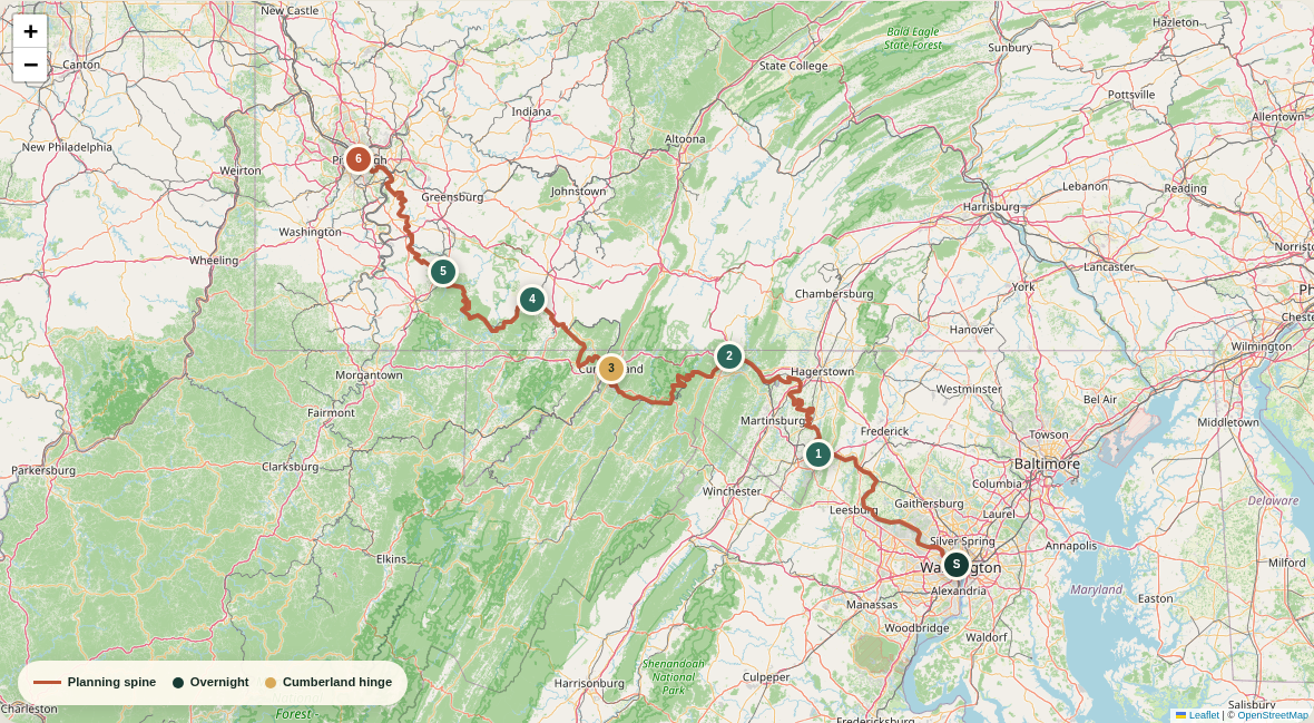
Navigation gate: download current official resources and detours before departure. Do not navigate from this page alone.
Open the underlying public route ↗Days from mile zero to the Point
The daily distances come from the GAP Conservancy's published itinerary, reversed for westbound travel. They total 333.3 miles because endpoint conventions differ slightly from the named trails' nominal 334.5 miles. Power figures are planning ranges—not manufacturer promises.
C&O Canal Towpath
Room in Harpers Ferry or Bolivar; Brunswick at mile 55 is the practical fallback while bridge access work affects loaded-bike access.
Hotel-firstHard-packed towpath, aqueduct crossings and occasional rough or muddy patches. Nearly level, but slower than pavement.
Highlights: Georgetown mile zero, Great Falls, Monocacy Aqueduct, Point of Rocks and the Potomac approach to Harpers Ferry.
Power: Plan 750–1,100 Wh for a loaded bike in ordinary conditions. Start with both batteries full if available.
Charge: No NPS charging on the towpath. Arrange an overnight outlet with the property before arrival; do not count on a lunch charge.
Gate: The current Byron Bridge stair project can make the town connection difficult for a loaded e-bike. Recheck the NPS project notice.
C&O Canal Towpath
Trail-accessible motel, inn or B&B in Hancock with confirmed indoor bike storage and battery-charging permission.
Hotel-firstLong, shaded towpath miles with historic locks, Big Slackwater's concrete river edge and a few town-access spurs.
Highlights: Antietam country, Shepherdstown access, Big Slackwater, restored Conococheague Aqueduct and the Western Maryland hills arriving at Hancock.
Power: Plan 800–1,150 Wh. Mud, soft resurfacing and headwind can matter more than elevation.
Charge: Leave full. Ask a Williamsport business before plugging in if a top-up is necessary; treat every intermediate outlet as a bonus.
Gate: High Potomac water can trigger a road detour around Big Slackwater. The road option is narrow and should be checked before departure.
C&O Canal Towpath
Downtown Cumberland hotel or trail inn near Canal Place; book secure storage and two-battery charging in advance.
Hotel-firstThe most remote canal day: towpath, wooded river bends, Paw Paw Tunnel and increasingly dramatic ridges near Cumberland.
Highlights: Western Maryland Rail Trail option, Sideling Hill country, Paw Paw Tunnel and the canal's mile 184.5 terminus.
Power: Plan 750–1,100 Wh and protect a 20% reserve. Temperature inside Paw Paw Tunnel can be sharply cooler.
Charge: Start full. A free GAP charging station is listed at Cumberland, but the overnight room remains the primary full-charge plan.
Gate: Current work includes a signed Dam No. 5 detour and a short WMRT detour near Polly Pond. Only Class 1 e-bikes are allowed on the WMRT.
Great Allegheny Passage
Rockwood guesthouse, inn or B&B. Inventory is limited, so reserve early and confirm dinner plus charging logistics.
Hotel-firstThe trip's defining climb: 1,767 feet of steady rise over 23.7 miles to the Eastern Continental Divide, then fast crushed-limestone miles.
Highlights: Cumberland Narrows, Brush Tunnel, Frostburg switchbacks, Mason–Dixon Line, Big Savage Tunnel and the 2,392-foot divide.
Power: Plan 700–1,050 Wh. Use low assist and a comfortable cadence on the climb rather than spending the battery in the first hour.
Charge: Leave Cumberland full. Public GAP charging is listed in Frostburg and Meyersdale; carry your own compatible charger and allow real charging time.
Gate: Big Savage Tunnel is seasonally closed from late November into early April with no detour. Mountain weather can be much colder than Cumberland.
Great Allegheny Passage
Connellsville hotel, hostel or B&B with secure storage. Reserve a ground-floor or elevator route for a heavy bike.
Hotel-firstA gentle net descent beside the Casselman and Youghiogheny, with bridges, forest shade and crowded sections near Ohiopyle.
Highlights: Salisbury Viaduct, Pinkerton bridges and tunnel, Confluence, Ohiopyle Falls and miles beside the Youghiogheny River.
Power: Plan 500–800 Wh. The easy grade rewards low assist; save battery for wind, soft trail or an unplanned lodging spur.
Charge: Leave full even though the profile is favorable. Ohiopyle is the natural lunch stop; Connellsville has a listed public charging station.
Gate: Slow down around Ohiopyle pedestrians and at road crossings. Summer weekends can make food service and lodging busier than the mileage suggests.
Great Allegheny Passage
Downtown or South Side Pittsburgh hotel, or proceed to a prearranged pickup. Confirm secure e-bike storage before celebrating.
FinishNearly level river corridor shifting from wooded rail-trail to former mill towns, bridges and urban trail through Pittsburgh's South Side.
Highlights: West Newton, industrial heritage at McKeesport and Homestead, Hot Metal Bridge, three-river skyline and the Point State Park finish.
Power: Plan 650–1,000 Wh. West Newton has a listed public charging station and is the best planned top-up point.
Charge: Begin full and charge at West Newton if range, wind or weather has been unfavorable. Finish with margin for the hotel or station transfer.
Gate: A two-mile Duquesne–Homestead closure is scheduled through August 6, 2026 with a paid daytime shuttle and no safe road detour. Recheck GAP alerts.
A 60-mile hotel stage is comfortable only when the bike has been tested at touring weight. One large battery may work in dry conditions; two removable packs create a much safer margin.
Conservative daily estimate
miles × tested Wh/mi × 1.20
63 mi × 14 Wh/mi × 1.20
≈ 1,058 Wh requiredMeasure consumption on 50–60 miles of damp gravel with full luggage before setting the battery plan.
Cool and dry packs before charging. Inspect cases, contacts, mounts and charger cables every evening.
Save higher assist for the Cumberland climb, soft surfaces, heat management and the final urban miles.
A weather reserve prevents one wrong turn, headwind or closed lunch stop from becoming a rescue call.
This is a room-first setup with enough self-rescue equipment to handle flats, chain trouble, darkness in tunnels and an unexpected delay between towns.
The machine
A rigid or short-travel e-bike with wide tires is appropriate. The C&O is the limiting surface; the GAP is smoother crushed limestone. Avoid loading that makes stairs, gates or hotel access impossible.
The field workshop
Wet grit accelerates chain and pad wear. A heavy e-bike is also harder to push, so tire and drivetrain repairs should be practiced before the trip.
The wet-day system
The canal corridor can flood, the towpath can become muddy and the mountain crest can be dramatically cooler. Keep insulation and electronics in separate waterproof layers.
The backup plan
Both trails are well marked, but storm detours and town spurs can be confusing. Keep the current route offline and make mile markers part of every emergency message.
DC and Pittsburgh are connected by Amtrak's daily Floridian, but many touring e-bikes do not meet Amtrak's published e-bike limits. Solve the return before committing to nonrefundable rooms.
Begin near the C&O terminus on the Georgetown waterfront. Photograph the bike and bags, share the day's clothing with your emergency contact and leave after daylight.
The GAP reaches downtown at Pittsburgh's three-river confluence. Keep enough battery for the final hotel, station or pickup transfer after the ceremonial finish.
The Floridian advertises trainside checked bicycle service between Pittsburgh and Washington with advance reservations. Amtrak's current special-item policy limits e-bikes to 50 pounds, standard bicycle dimensions and 2-inch tires; the rider must load the vehicle without staff assistance, and charging is prohibited on Amtrak property. Many full-size touring e-bikes exceed at least one limit.
Facts and alerts were reviewed on July 31, 2026. Mileage is drawn from official NPS/GAP materials and the GAP Conservancy's recommended itinerary. Energy numbers are conservative planning estimates that must be replaced with the rider's own loaded-bike test data.