Weather controls the surface
Rehabilitated sections can roll beautifully. Older sections can become slow mud after heavy rain. Keep one buffer day and avoid using pavement range as your battery forecast.
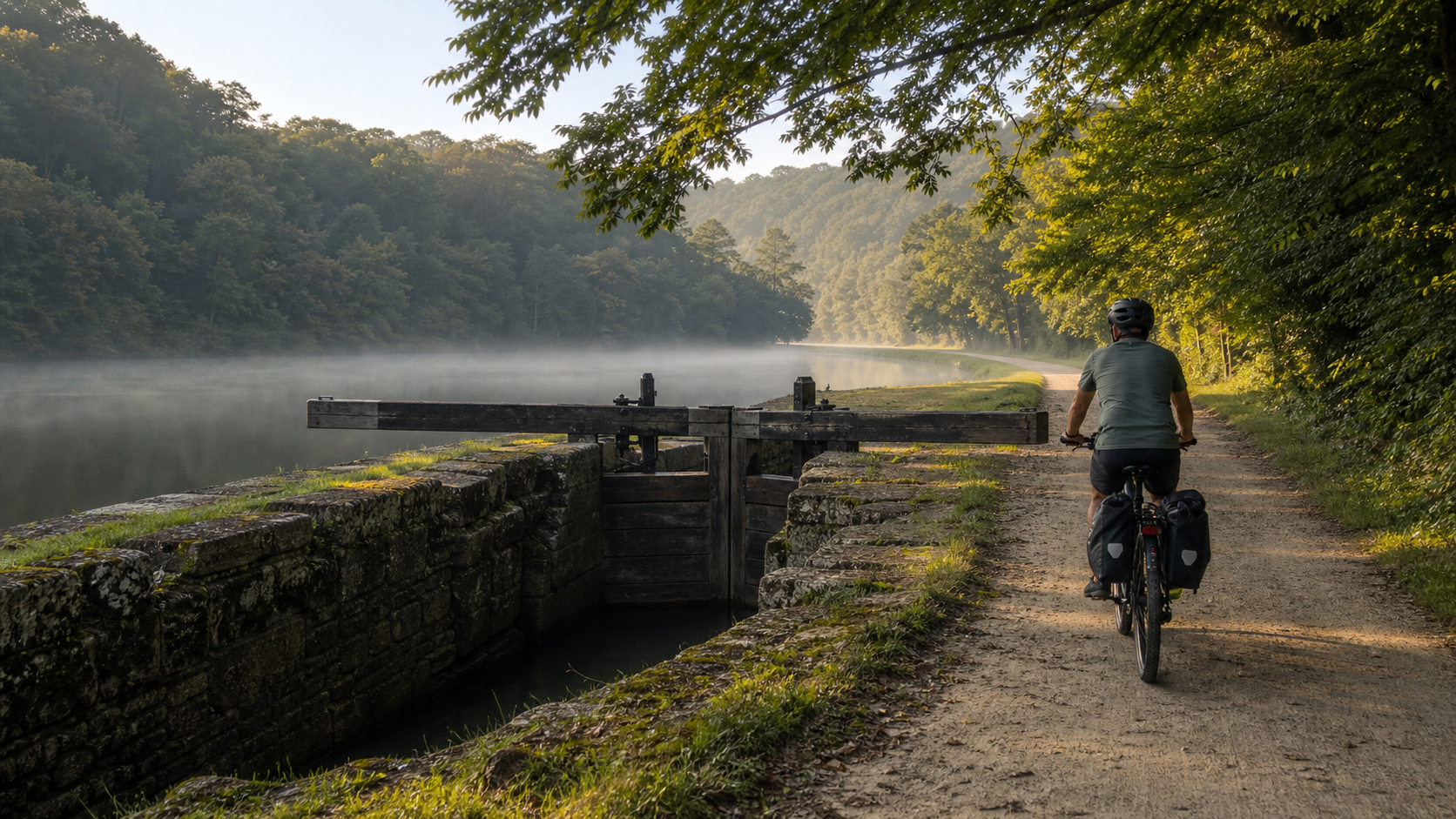
Georgetown → Cumberland · Westbound
A three-day, hotel-first e-bike plan for 184.5 miles of Potomac water, canal engineering and Appalachian quiet.
The C&O Canal Towpath runs the full 184.5 miles from Georgetown in Washington, DC, to Canal Place in Cumberland, Maryland. The National Park Service says cyclists normally take three to seven days. This plan chooses the brisk end of that range: three loaded days of roughly 60 miles, with rooms in Harpers Ferry/Bolivar and Hancock.
The route is nearly level because every rise is absorbed by an old canal lock. That does not make it effortless. Unimproved towpath, wet limestone, roots, puddles, headwinds and a heavy e-bike can turn 60 miles into an all-day ride. The winning strategy is simple: start early, keep assist low, and arrive with daylight and battery reserve.
Rehabilitated sections can roll beautifully. Older sections can become slow mud after heavy rain. Keep one buffer day and avoid using pavement range as your battery forecast.
NPS provides no towpath charging. Confirm a safe outlet, secure bike storage and permission to charge the battery before booking each overnight.
The town connection currently relies on a limited shuttle without a bike rack. Brunswick at mile 55 keeps the ride on the towpath if a loaded bike cannot get across.
The towpath rule
Sixty flat miles are still sixty trail miles.
This is a dated snapshot—not a forecast for your departure. Open the official conditions page 72 hours before the ride, again the evening before, and each morning on the trail.
The towpath remains open, but the temporary bridge stairs closed July 27. The NPS shuttle runs 9:00 a.m.–6:30 p.m., weather permitting. It has no bike rack; one or two bikes may ride inside only at the driver's discretion.
Read the NPS project notice ↗Dam No. 5 currently uses a short mulch path and wooden stairway. Polly Pond sends riders onto roughly two miles of the Western Maryland Rail Trail, where only Class 1 e-bikes are allowed.
Open current C&O conditions ↗The 3,118-foot tunnel is open, dark, damp and sharply cooler than the towpath. NPS directs cyclists to dismount in the tunnel and on boardwalks. Carry a headlamp even for a daylight arrival.
Read the tunnel guidance ↗E-bike access
NPS defines an e-bike here as a two- or three-wheeled cycle with fully operable pedals and an electric motor of less than 750 watts.
Read the NPS bicycle rules ↗Away from public motor roads, the motor may not move the bike without pedaling. The maximum speed on designated park routes is 15 mph.
Verify the operating rule ↗The optional paved Western Maryland Rail Trail—and the current Polly Pond detour using it—permits only Class 1 e-bikes. A throttle-equipped bike is not automatically Class 1 because the throttle is unused.
Check the WMRT note ↗The route line uses the C&O portion of a public Ride with GPS Ambassador route and is rendered over OpenStreetMap. It shows the corridor and overnight pattern—not current detours or turn-by-turn navigation.
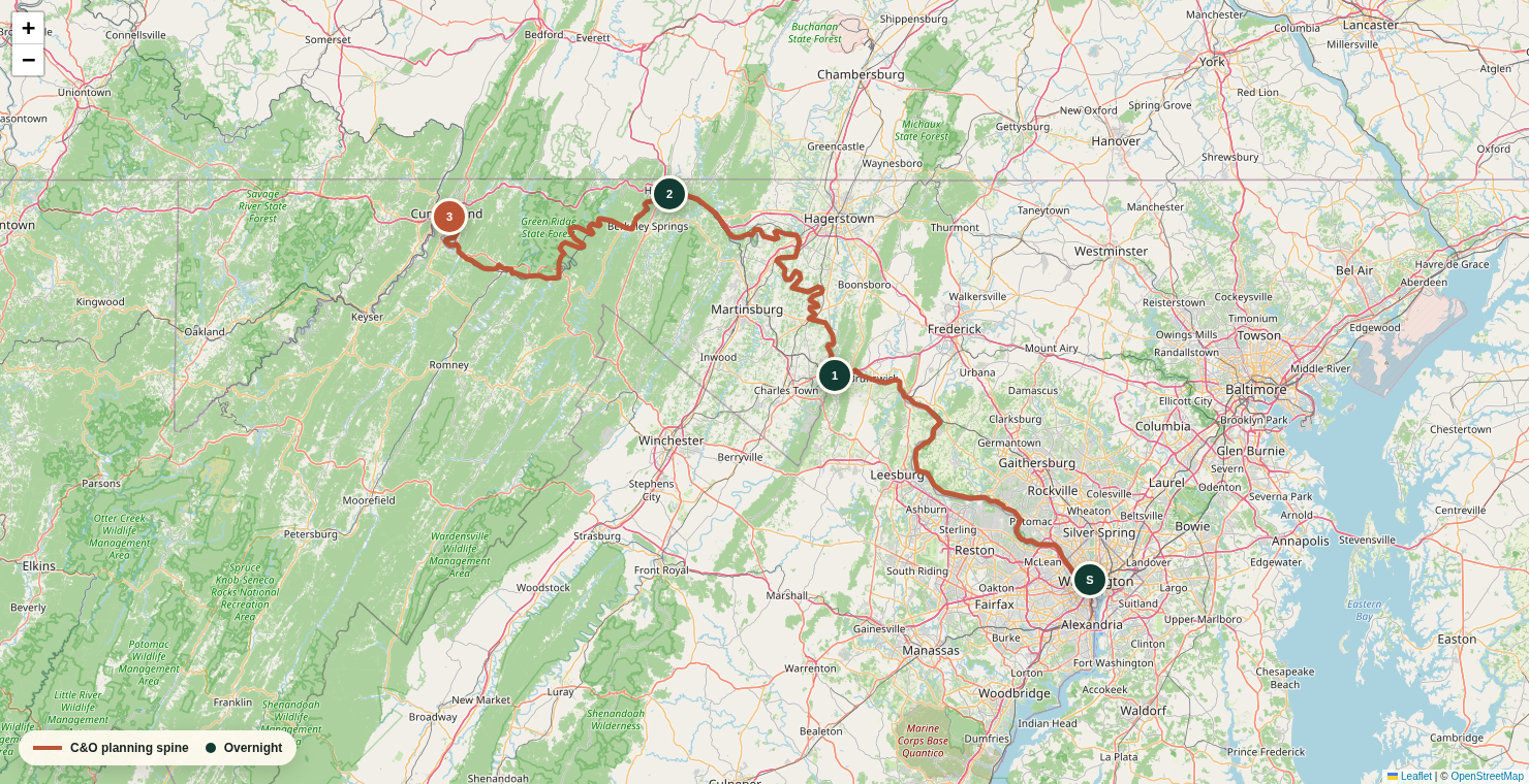
Navigation gate: carry a current offline route, NPS park maps and current detours. Do not navigate from this page alone.
Open the underlying public route ↗Days from mile zero to mile 184.5
The stage miles total exactly 184.5. Battery figures are conservative planning ranges for a loaded e-bike on mixed towpath—not manufacturer claims. Test your own bike before committing.
C&O Canal Towpath
Room in Harpers Ferry or Bolivar only after confirming loaded-bike access. Brunswick at mile 55 is the clean fallback.
Hotel-firstUrban canal edge becomes shaded towpath, aqueduct country and broad Potomac bends. Mostly hard-packed, with mud and roots possible after rain.
Highlights: Georgetown mile zero, Great Falls, Monocacy Aqueduct, Point of Rocks and the river approach to Harpers Ferry.
Power: Budget 750–1,100 Wh and finish with at least 20% reserve. Start with every battery full; there is no official NPS charging.
Food + water: Carry lunch and two full bottles. Potable NPS water exists on the lower canal, but status can change; town services are the dependable meal plan.
Charge: Use only the approved charger in a dry, ventilated location with the property's permission. Do not charge a hot, wet or damaged pack.
Gate: The current Harpers Ferry shuttle has no bike rack. If bicycle space is unavailable—or the shuttle is suspended for weather—continue 5.7 miles back to Brunswick lodging rather than improvising on roads.
C&O Canal Towpath
Trail-accessible motel, inn or B&B in Hancock with confirmed indoor bike storage and battery-charging permission.
Hotel-firstA long, shaded corridor of locks and river bends, with Big Slackwater's concrete shelf and the restored Conococheague Aqueduct near Williamsport.
Highlights: Antietam country, Shepherdstown access, Big Slackwater, Williamsport and the narrowing Maryland panhandle.
Power: Budget 800–1,150 Wh. Mud, soft resurfacing and a west wind can matter more than the negligible elevation.
Food + water: Carry breakfast fuel and trail food; Williamsport near mile 99.8 is the natural lunch and municipal-water reset. Treat hiker-biker well water before drinking.
Charge: Leave full and treat any lunch top-up as a bonus, never as the plan. Hancock is the night's full electrical reset.
Gate: High Potomac water can close Big Slackwater and trigger a narrow local-road detour. Obey closure signs and recheck river/towpath conditions before leaving.
C&O Canal Towpath
Finish at Canal Place, then use a downtown room, prearranged pickup or a transportation plan already confirmed before day one.
Terminus nightThe most remote stage: wooded bends, longer gaps between services, dramatic ridges, Paw Paw Tunnel and the final run into Cumberland.
Highlights: Western Maryland mountain corridor, Little Orleans, Sideling Hill country, Paw Paw Tunnel and mile 184.5 at Canal Place.
Power: Budget 750–1,100 Wh and protect a 20% reserve for soft surface, temperature or a lodging transfer.
Food + water: Start with a full day's calories. Little Orleans is the logical early service stop; after that, carry enough to be self-sufficient. Hiker-biker wells are non-potable and require treatment.
Charge: Start full. Do not rely on finding power between Hancock and Cumberland. The room or pickup vehicle is the primary finish-day charging plan.
Gate: Walk the bike through Paw Paw Tunnel with a headlamp. The Polly Pond detour uses the Class 1-only WMRT; riders with other e-bike configurations must confirm a legal alternative with NPS before departure.
Slow down if your proven gravel range, daylight, weather or preferred sightseeing pace says so. These alternatives are planning patterns; lodging availability and charging permission still need confirmation.
Georgetown → Harpers Ferry (60.7) → Williamsport (39.1) → Hancock (24.3) → Cumberland (60.4).
Two short central stages create time for Antietam, aqueducts and a relaxed charge. The same Harpers Ferry access gate applies.
Georgetown → Brunswick (55) → Williamsport (44.8) → Hancock (24.3) → Paw Paw (about 32) → Cumberland (about 28).
The Paw Paw night may require camping or limited local lodging. Verify food, battery charging and availability before adopting this version.
Do not compress a rain delay into a 90-mile rescue day. Shift the reservation chain, shorten at Brunswick or Williamsport, and protect daylight.
The towpath usually becomes slower before it becomes technically difficult. Time and watt-hours disappear together.
The relevant number is your own loaded watt-hours per mile on wet gravel—not the range printed on the bike's product page.
Field estimate
Example: 1,100 usable Wh ÷ 15 Wh/mi
73 theoretical miles → plan roughly 58 with a 20% reserveRide 35–45 local gravel miles with touring weight, the tires and the assist level you will actually use.
Use the higher consumption result from wind, soft trail or cold—not your best ride.
Reserve covers mud, a missed town entrance, detour, headwind or a battery that is aging faster than expected.
Use the approved charger on a stable nonflammable surface; never charge a wet, hot, swollen or damaged pack.
NPS explicitly says it does not offer charging locations along the towpath. Every overnight outlet is a private arrangement, so confirm the room, storage and charging rules directly.
This is a room-based ride, not ultralight camping. The load should solve towpath failures, protect the battery and keep you visible without turning the bike into a freight train.
System 01
Build for wet limestone, roots and a heavy rear wheel.
System 02
Keep the electrical system dry, known and legal.
System 03
The canal is shaded, humid and deceptively easy to under-fuel.
System 04
A smooth day ends with a known door, outlet and bike location.
Decide the return before reserving rooms. A loaded touring e-bike often fits a bicycle shuttle more easily than Amtrak's published limits.
Commercial operators advertise C&O service for riders, bikes and gear. Confirm the exact Cumberland pickup, DC drop-off, bike length, tire width, total loaded weight, battery handling and whether panniers stay on the bike.
Shepherdstown Pedal & Paddle ↗ · C&O Bicycle ↗ · Wheelzup Adventures ↗
The current Floridian timetable links Cumberland and Washington, and Amtrak lists trainside bicycle service with advance reservations. But Amtrak's published e-bike limit is 50 pounds, standard dimensions and at most 2-inch tires. The bike and battery must have qualifying laboratory certification, and the passenger must handle the bike without assistance.
Cumberland is an unstaffed station with no checked baggage service, no bike boxes and no baggage assistance. Verify that the reservation system offers bicycle space for the exact Cumberland–Washington departure before relying on it.
Floridian route ↗ · Current timetable ↗ · E-bike rules ↗ · Cumberland station ↗
If one answer is no, repair the plan—not your expectations.
Confirm motor rating, pedal-required operation and Class 1 status if using the active WMRT detour.
Use a real ride and keep 20% battery reserve. Pavement estimates do not count.
Get direct confirmation of controlled storage, outlet location and charging permission.
Know the NPS shuttle window and carry Brunswick lodging details before leaving Georgetown.
Review NPS conditions 72 hours before departure and each morning; save the page and map offline.
Hiker-biker wells are signed non-potable. Carry a treatment method and municipal-water backup.
Practice removing the e-bike wheel, fixing a flat and reinstalling it with the tools you will carry.
A ticket is not enough if the bike violates weight, tire or handling limits. Confirm the exact bike acceptance.
Primary route and rule sources: NPS bicycling and e-bike rules, current park conditions, Byron Bridge and shuttle notice, camping and water guidance, Paw Paw Tunnel, and the NPS C&O FAQ.
Planning context: the official park partner's C&O Canal Trust biking guide and town information. The route overview uses the C&O portion of Ride with GPS Ambassador Route 14293085 over OpenStreetMap.
Return planning: Amtrak Floridian, the current official timetable, Amtrak special-item limits, and the Cumberland station page.
Freshness: official conditions and operating policies checked August 1, 2026. Power consumption, travel time and alternate-stage splits are planning estimates. This is an editorial planning aid, not a purchased route, lodging reservation, safety guarantee or substitute for live NPS instructions.